
Free Lost Pet Command CenterCreate a missing-pet case and use community recovery tools
Emergency Cat Help
KC Pet Search & Rescue
Call Now 913-915-2800
Emergency Dog Help
KC Pet Search & Rescue
Call Now 913-915-2800
Free Lost Pet Command CenterCreate a missing-pet case and use community recovery tools
Emergency Cat Help
Emergency Dog Help
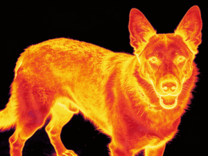
Thermal-image style illustration of a dog wearing a collar, representing thermal drone detection of a missing dog
Johnson County, Kansas Lost Dog Recovery

Lost Dog Recovery in Johnson County With Thermal Drone Search

KC Pet Search & Rescue helps families locate missing dogs across Johnson County — Olathe, Overland Park, Lenexa, Shawnee, Gardner, Leawood, De Soto, Spring Hill, and the surrounding communities. A frightened dog may move through neighborhoods, parks, creek corridors, greenbelts, farmland, and wooded areas, and chasing or uncontrolled searching can push it farther.

Thermal drone search can help evaluate large outdoor areas when conditions are suitable — but the goal is never simply to fly a drone. The goal is to build a controlled recovery plan around your dog's behavior, the terrain, and what's actually being seen.

Your Dog May Still Be Moving. Start With a Recovery Plan.

Every submitted lost-dog recovery form receives a free consultation. KC Pet Search & Rescue reviews the escape, sightings, terrain, timing, and dog behavior — early coordination can reduce wasted searching and unnecessary pressure.

Why Recoveries Go Sideways

Why Lost Dogs Become Harder to Locate

Most owners mean well. The problem is that the wrong kind of searching can push a dog farther, faster, and into terrain that's harder to control.

Thermal drone footage showing an animal heat signature moving through tall grass and brush
Thermal imaging can reveal heat signatures moving through grass and brush that are easy to miss from the ground.

Fear & Flight Mode

Pursuit can trigger survival instinct instead of normal pet behavior.

Chasing

Running toward the dog or following in a car often keeps it moving.

Search Crowds

Large groups walking and calling can add pressure instead of relief.

Inaccurate Sightings

Vague reports without time or location make movement hard to trace.

Growing Search Radius

Without a plan, the search area can expand faster than it can be covered.

Terrain

Creek corridors, greenbelts, and wooded edges can hide movement entirely.

Nighttime Movement

Many dogs travel farther after dark, when fewer people are watching.

Repeated Vehicle Loops

Slow driving loops can add noise without adding useful information.

Uncoordinated Helpers

Well-meaning volunteers without a shared plan can duplicate effort or push the dog off course.

The Path Forward

From a Growing Search Area to a Focused Recovery Plan

What Families Are Facing

  • The dog may still be moving
  • Sightings are spread out
  • The dog runs when approached
  • Searchers are checking the wrong places
  • Terrain limits visibility
  • Social-media reports are disorganized
  • The owner does not know what to do next

How KC Pet Search & Rescue Responds

  • Reviews the escape and behavior
  • Organizes sightings by time and location
  • Evaluates terrain and likely travel corridors
  • Identifies high-probability thermal search areas
  • Reduces unnecessary pressure
  • Provides next-step recovery guidance
  • Uses aerial search when conditions support it
  • Communicates with the owner during the search
Professional Search Technology

How Thermal Drone Search Helps Locate Missing Dogs

Thermal drones can help inspect fields, wooded edges, creek corridors, parks, golf courses, greenbelts, large residential properties, farm ground, industrial edges, drainage corridors, and retention areas — terrain that's slow or unsafe to cover on foot.

Live thermal camera feed from a KC Pet Search & Rescue drone scanning tree canopy during a search
Live thermal feed from a search deployment, scanning tree canopy for heat signatures.
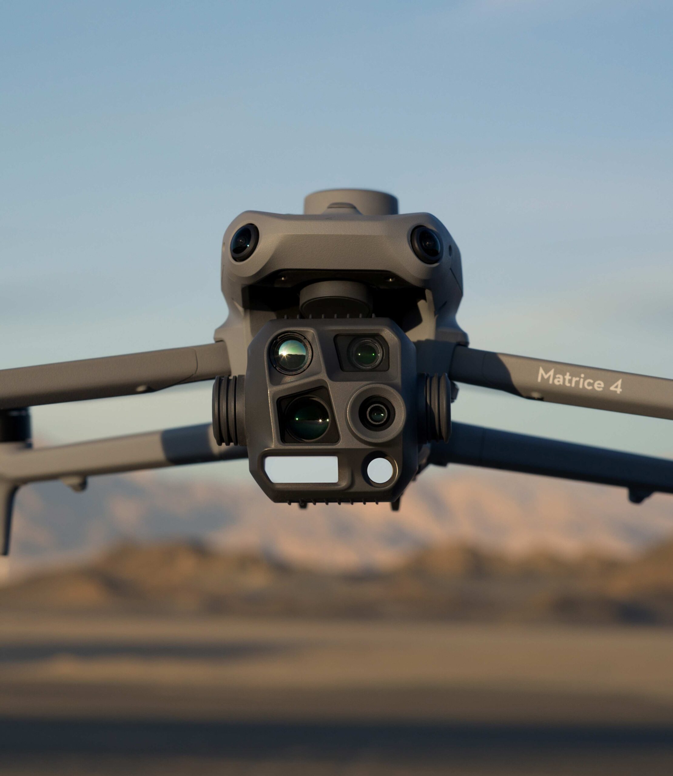
DJI Matrice 4 thermal drone in flight, used by KC Pet Search & Rescue for aerial search operations
The DJI Matrice thermal platform used for Johnson County search deployments.

What Thermal Search Can Do

  • Covers large areas efficiently
  • Reduces pressure from ground searchers
  • Evaluates difficult terrain
  • Detects heat signatures under suitable conditions
  • Provides a broader view of movement corridors
  • Supports real-time coordination

What It Cannot Do

  • Cannot see through buildings
  • Dense vegetation may reduce visibility
  • Weather and temperature contrast matter
  • Legal airspace and flight access matter
  • The dog must be inside the searched area
  • No method guarantees a location
Local Terrain

Why Johnson County Terrain Changes the Search

Suburban neighborhoods, creek systems, drainage corridors, greenbelts, parks, golf courses, wooded strips, farmland, construction areas, industrial property, highway corridors, and city boundaries all shape how far — and where — a dog is likely to move.

Aerial thermal view of wooded tree canopy captured during a drone search
Neighborhood Greenbelt Creek Corridor Park Wooded Edge

Dogs often move along connected terrain instead of following straight roads. A route like this — from a residential backyard into a greenbelt, along a creek corridor, through a park, and into a wooded edge — is common across Johnson County, and it's why two sightings that look far apart on a map can still be part of the same path.

Suburban neighborhoods Creek systems Drainage corridors Greenbelts Parks Golf courses Wooded strips Farmland Industrial property Highway corridors
⚠ Do Not Chase

Seeing Your Dog Is Not the Same as Recovering Your Dog

Frightened dogs may run from owners, family members, familiar voices, food, vehicles, neighbors, and search teams. Fear can temporarily override familiar behavior — it doesn't mean the dog no longer knows or loves its family, it means the dog is reacting to perceived danger, and the recovery strategy has to reduce pressure long enough for it to slow down and feel safe.

Actions That May Push the Dog Farther

  • Running toward the dog
  • Calling repeatedly
  • Following in a car
  • Surrounding the dog
  • Sending crowds into cover
  • Posting a live location publicly
  • Attempting a rushed grab

Actions That Support Recovery

  • Stop and observe
  • Save an exact map pin
  • Record the time and direction
  • Keep the sighting quiet
  • Reduce traffic
  • Contact KC Pet Search & Rescue
  • Wait for a controlled plan
Turn Sightings Into Direction

What Makes a Sighting Useful

A useful report includes an exact map pin, exact time, direction of travel, dog behavior, speed, nearby terrain, a photo or video, whether the dog was approached, and whether a collar, leash, or harness is still attached.

Record These Details

  • Exact map pin or address
  • Exact time of the sighting
  • Direction of travel
  • Speed and behavior
  • Nearby terrain
  • Photo or video
  • Whether the dog was approached
  • Whether a collar, leash, or harness is attached

How KC Pet Search & Rescue Uses It

  • Builds a movement timeline
  • Identifies likely travel corridors
  • Plans aerial search zones
  • Reduces duplicate searching
  • Determines the next step
Johnson County Service Area

Serving Families Across Johnson County

KC Pet Search & Rescue responds to lost-dog cases throughout Johnson County, Kansas, with a dedicated focus on the neighborhoods, parks, greenbelts, and creek corridors that shape local movement.

Also serving Mission, Merriam, Roeland Park, Fairway, Edgerton, Stilwell, and surrounding unincorporated Johnson County.

How It Works

How the Recovery Process Works

1

Submit the Recovery Form

Provide current sightings, escape details, photos, and behavior information.

2

Receive a Free Consultation

KC Pet Search & Rescue reviews the situation and recommends next steps.

3

Build the Search Plan

The team evaluates terrain, timing, thermal conditions, sightings, and pressure.

4

Deploy the Right Tools

Thermal drone search, observation, monitoring, and guided recovery support may be used where appropriate.

Not every case requires the same response — the plan is built around your dog's specific situation.

Izzy's real lost dog recovery, a documented KC Pet Search & Rescue field case
Real Recovery Footage

Real Recovery: Izzy

Izzy's case demonstrates rapid response, aerial visibility, search-area reduction, calm coordination, and real field capability — the same approach applied to Johnson County cases.

Watch Izzy's Recovery
Callie's real lost dog recovery in Olathe, Kansas, a documented Johnson County field case
Another Real Johnson County Recovery

Callie's Olathe Recovery

A real thermal drone search case from right here in Johnson County — a documented field recovery, not a demonstration.

Watch the Recovery

Watch More Real Lost Dog Recoveries

KC Pet Search & Rescue publishes genuine field recovery videos so families can understand how real searches unfold.

Explore the Dog Recovery Video Library
Real Kansas City Families

Trusted by Kansas City Pet Owners

Families across Johnson County and the Kansas City area have trusted KC Pet Search & Rescue for calm guidance, advanced search tools, and structured lost-pet recovery support.

★★★★★

"The best search and rescue there is! He helped us find our pup before the fireworks got too loud on the 4th of July."

— GK, Missing Dog Recovery

★★★★★

"Jay was able to use his services with his drone to detect motion and visuals in the area where Buoy's AirTag was pinging."

— Haley Pitcairn, Buoy's Recovery

★★★★★

"He came out on a holiday to help us find our dog. Jay really cares about your family, your lost animal, and the service he provides."

— Amber Stephens, Lost Dog Search

The Complete Process

What KC Pet Search & Rescue Does Differently

The difference isn't just owning a drone. It's the complete process behind every deployment.

FAA Part 107 Certified

Operations are conducted under a licensed remote pilot certificate.

Professional Thermal Equipment

Purpose-built thermal imaging, not a consumer camera drone.

Lost-Dog Behavior Awareness

Search strategy is built around fear response and flight-mode behavior, not guesswork.

Terrain & Corridor Analysis

Johnson County's neighborhoods, creeks, and greenbelts are evaluated as connected routes.

Current Sighting Evaluation

Reports are organized into a timeline rather than treated individually.

Real-Time Field Communication

Owners are kept informed as the search develops, not left waiting.

Pressure-Reduction Strategy

Reducing chasing and crowding is part of the plan, not an afterthought.

Kansas City-Area Experience

Familiarity with local terrain built through real field deployments.

Structured Recovery Planning

Every case follows a plan — not random activity.

Johnson County Lost Dog Questions

Frequently Asked Questions

Answers to the questions Johnson County families ask most about lost-dog recovery and thermal drone search.

How far can a lost dog travel?

Some dogs stay within a few blocks of home, while frightened or continuously moving dogs can travel several miles. Temperament, terrain, timing, and human pressure all affect distance.

Do lost dogs stay close to home?

Many begin close to the escape point, but that doesn't guarantee they stay there — dogs may circle, hide nearby, or leave the area after being chased or frightened.

Do lost dogs move more at night?

Many frightened dogs move during quieter evening, overnight, or early-morning hours when traffic and human activity decrease.

Can chasing make a lost dog travel farther?

Yes. Running toward the dog, following it in a vehicle, or sending groups into an area can trigger another flight response.

Can thermal drones find dogs in woods?

Thermal drones can help identify heat signatures in wooded areas when tree cover, weather, and temperature contrast are suitable.

Can thermal see through trees?

Thermal can often detect heat through gaps in tree cover, but dense canopy and heavy vegetation can reduce or block visibility.

Can thermal see through buildings?

No. Thermal imaging cannot see through solid structures such as homes, garages, or sheds.

What weather is best for thermal search?

Cooler temperatures with strong contrast between the ground and an animal's body heat typically produce the clearest results, often overnight or early morning.

Does every case require a drone?

No. Not every case needs thermal drone search — the right response depends on terrain, sightings, and the dog's behavior, and is determined during the free consultation.

When should KC Pet Search & Rescue be contacted?

Contact us when the dog is still moving, sightings are spreading out, the dog runs from people, terrain limits visibility, or the search lacks a coordinated plan.

What information should I submit?

The exact escape location and time, recent sightings with direction of travel, photos, and details about your dog's temperament and behavior.

Does every recovery form receive a free consultation?

Yes. Every submitted lost-dog recovery form receives a free consultation before you commit to any service.

What Johnson County cities are served?

Olathe, Overland Park, Lenexa, Shawnee, Leawood, Gardner, De Soto, Spring Hill, Prairie Village, and the surrounding Johnson County communities.

Is thermal drone search guaranteed?

No search method can guarantee a location. Results depend on terrain, vegetation, weather, legal flight access, and whether the dog is within the searched area.

What happens after a dog is located?

KC Pet Search & Rescue helps determine the safest next step — protecting the location, reducing activity around the dog, and coordinating a calm, controlled approach.

Johnson County Lost Dog Recovery

Stop Expanding the Search. Start Building a Recovery Plan.

A missing dog may move through neighborhoods, greenbelts, creek corridors, parks, farmland, or terrain that cannot be searched effectively from the ground. More people and more calling are not always the answer. Better information, the right technology, and a controlled recovery strategy can change the direction of the search. KC Pet Search & Rescue helps Johnson County families put those pieces together.

Back to top